Global
A repeatable offshore infrastructure concept for regions where energy, digital demand and water constraints intersect.
The G in GFPSO
GFPSO is conceived as infrastructure at the intersection of the world's offshore energy resources, submarine fibre routes, coastal utility systems and growing compute demand.
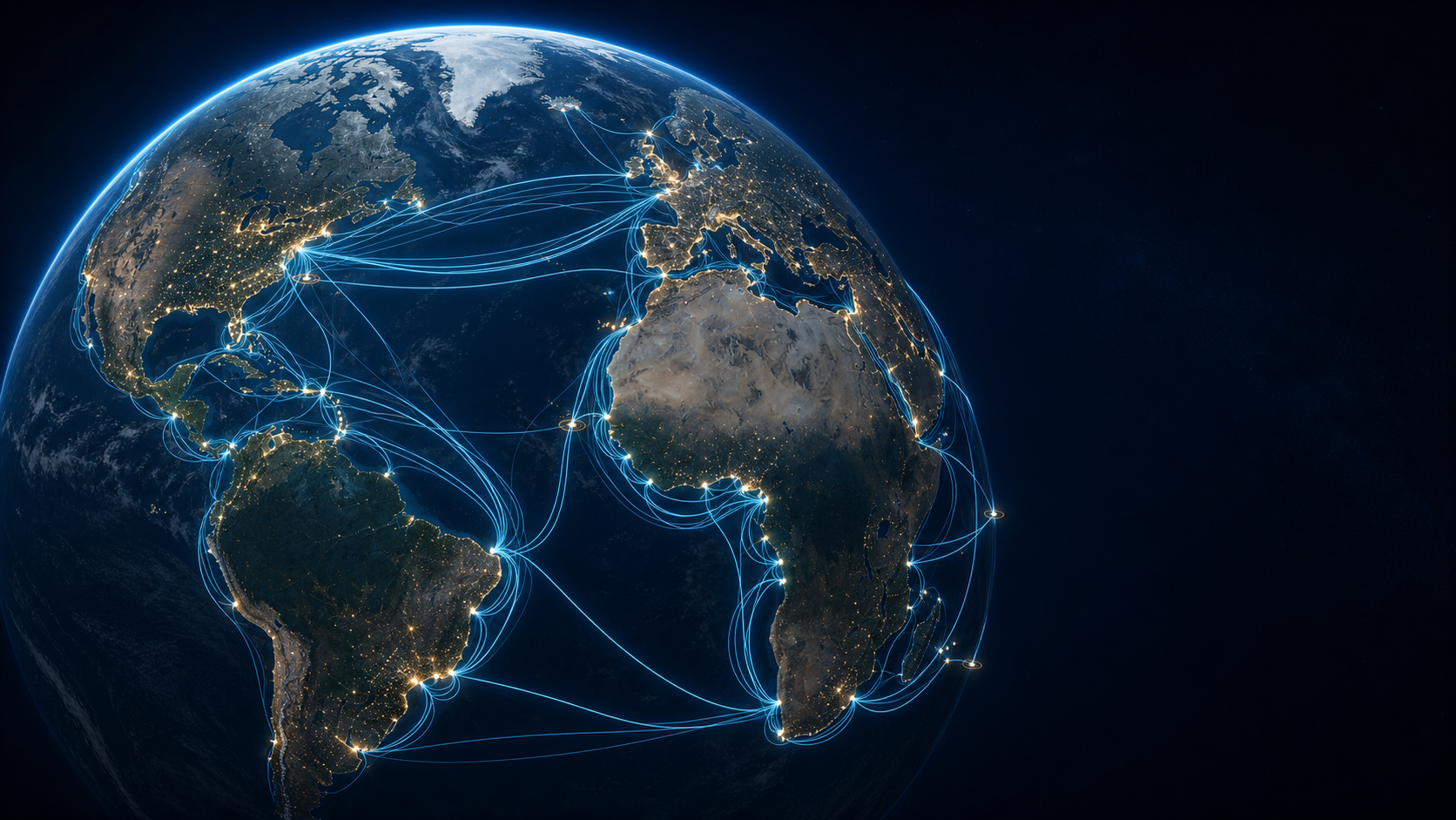
A repeatable offshore infrastructure concept for regions where energy, digital demand and water constraints intersect.
Connection to submarine fibre, coastal power systems and water infrastructure—screened together instead of as separate projects.
Conversion of stranded or infrastructure-constrained gas into power and digital work where export by pipeline or LNG is impractical.
Infrastructure screening
Regional screening overlays offshore fields and platforms, submarine fibre, coastal power and water infrastructure, and announced compute demand. The purpose is to identify where a GFPSO study may be worth advancing—not to prescribe a site, cable route or investment decision.
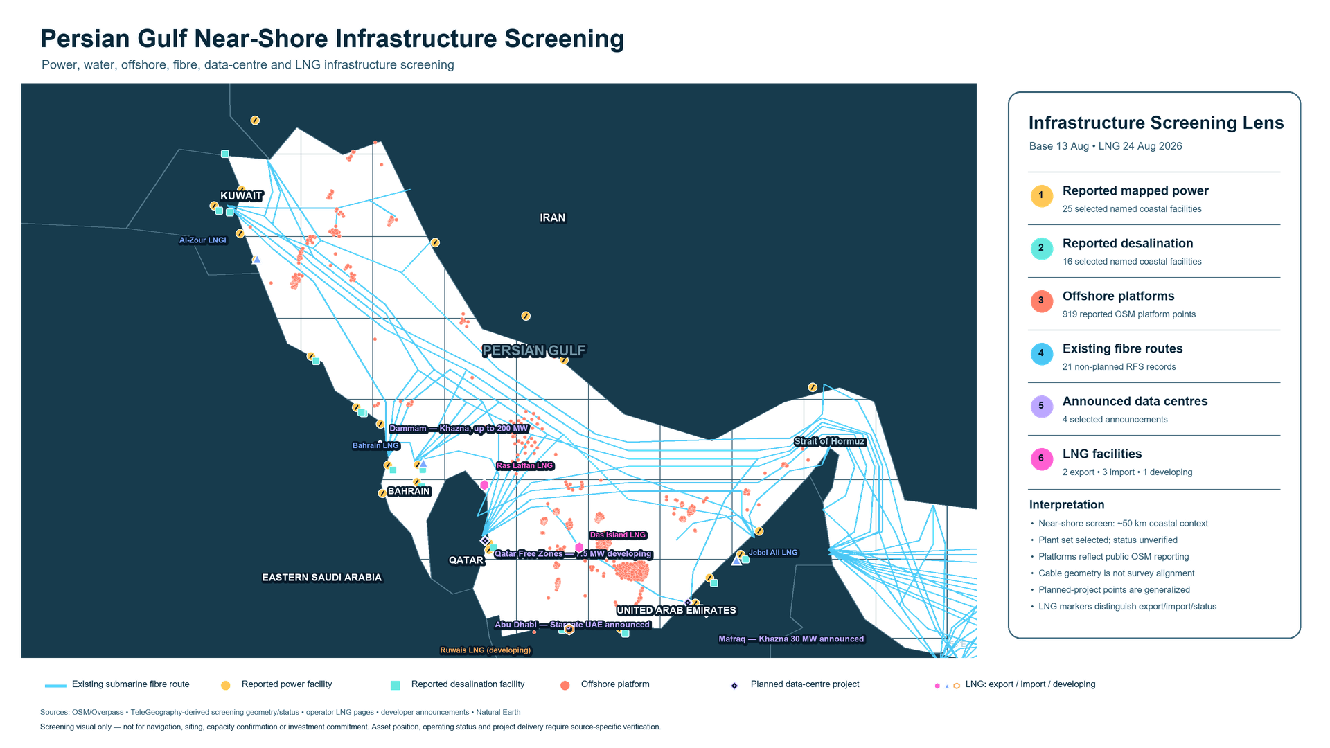
Near shore
The Gulf combines established power-and-water complexes, offshore production, international fibre landings, LNG infrastructure and fast-growing demand for sovereign compute. A near-shore GFPSO could be screened as new grid-connected infrastructure that produces compute and fresh water together.
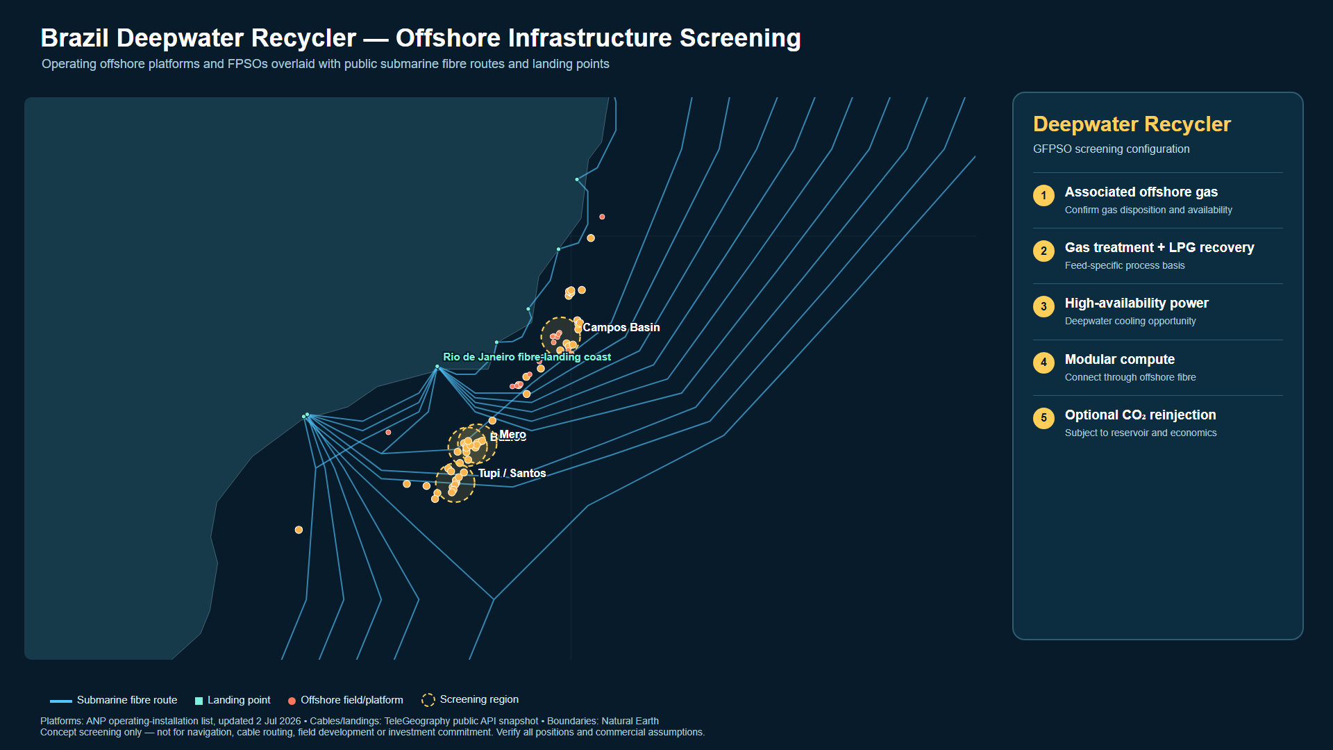
Deepwater
Deepwater regions may hold gas that is technically available but constrained by distance, pipeline capacity or commercial scale. GFPSO screens a different export pathway: convert the gas offshore into power and digital work, with the ocean as the final heat sink where water export is not practical.
Next regional screens
Each regional map will use the same evidence structure: offshore resources, power, water, fibre, industrial demand and permitting context. Candidate locations require project-specific engineering, commercial validation and stakeholder approval.
Collaborate
We are seeking energy, fibre, water, compute and investment partners to validate regional infrastructure screens and advance the strongest cases into feasibility studies.